Cezary Pluskwa wrote:
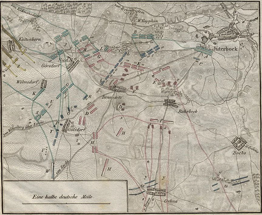
In 1806-07, during the Autumn-Winter Campaign in Prussia and Poland, main communication route ran from Mainz (Mayence), Frankfurt, Magdeburg, Berlin and Kostrzyn (Oder), a total of 21 stages, 161 leagues. From 6 to 10 leauges per stage.
An equally important, similar route from Leipzig to Berlin ran through Duben, Wittenberg, Treuenbrietzen, Beelitz, and Potsdam.
So it bypasses the small Juterbog and the smaller Dennewitz. Is there a difference between 1806 and 1813?
If the first ones are pikes, the smaller ones here are the main roads.
And what does it look like in terms of mechanics, engine code, time traversing the map in time of battle?
I realize that I need to look over the Berlin Campaign map too and make some changes to it. I plan on working on the Dennewitz map first and then clear out a space for it on the bigger map and paste it in. Fortunately, I made sure that both maps share the same elevations so i wont have to adjust any of those.

Yes, you bring up some good questions. The pike routes will make for quicker traversing of the map. What effect will that have on the scenarios?
For that reason alone I plan on holding off on having Rich Hamilton add these revised map files into the 4.07 update and I am asking for volunteers to step forward who will test the Battle of Dennewitz with me. I know that the 3rd Korps march will be different and might even mirror the historical choices more meaning that the French IV Corps will not have free reign to pounce on the Prussian 4th Korps. Now the 3rd Korps will be better able to support them.
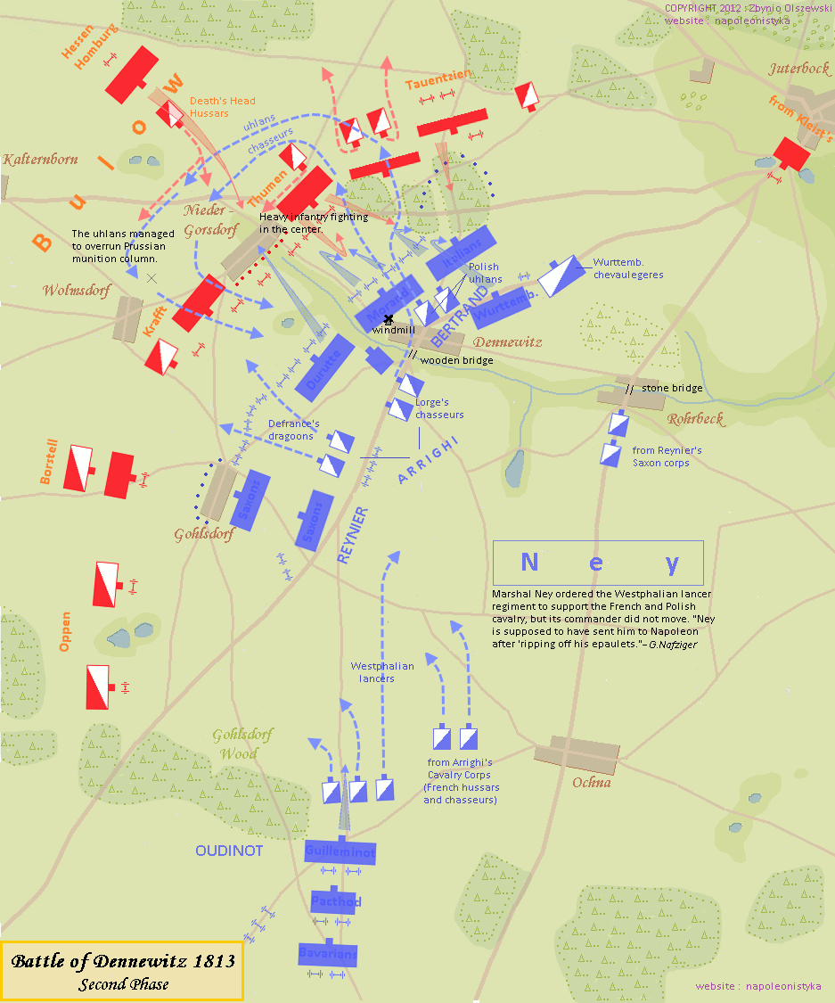
I am not sure why I didn't pick up on this more when I was reading George Nafziger's account of the battle. These maps I have found help me to know where the two northernmost brigades were located. They were attacking the French left flank but more to the north than how it turns out in our games. Once you see the map you will understand that now the Allied player will have a better chance of uniting the two corps earlier than we normally see.
But I agree, Cezary, that we need to keep the amount of pike routes down to just what was there. These older maps are not always reliable. I do think that the map that we have lacks several routes.
Another thing is: we tend to react to movements that are far from the troops we end up moving in reaction to the enemy's movement. I truly wish we had some sort of orders system. Especially if its a French, Russian or Swedish division or Prussian brigade out of command range of its Corps commander.
I am almost ready to start playing a House Rule that reads: unless your division commander is in command range of the corps commander you may not react to movements that are more than 30 hexes away from your position. For detached brigades: more like 15 hexes. We tend to do a lot of "Reaction Movement" in our play. I know I am guilty of it. In our Empire III miniature games you had orders and in order to get them changed your leadership had to get the orders passed down. For the French with Napoleon present it was not as hard as if you were the Allies of 1805. The Prussians, by this time, had a better staff system. In this battle we are talking about Ney in command. Its not Napoleon and Berthier plus that huge HQ that they had.
But anyway, tomorrow I will spend more time on the map and see if I cant get most of it done but I am not pushing it these days. So lets take this on as a project and if you and Christian want to help playtest it that is fine but if not then how about just giving some comment on the work?
Thanks for your input.
_________________

Generalfeldmarschall Wilhelm Prinz Peters von Dennewitz
3. Husaren-Regiment, Reserve-Kavallerie, Preußischen Armee-Korps
Honarary CO of Garde-Ulanen Regiment, Garde-Grenadier Kavallerie
NWC Founding Member
For Club Games: I prefer the Single Phase mode of play. I prefer to play with the following options
OFF:
MDF, VP4LC, NRO, MTD, CMR, PR, MIM, NDM, OMR (ver 4.07)


