John Ferry wrote:
It took me a while to read through the various posts in this thread. I hope that I am offering something new here. First, Doug Strickler made the monster (master) map for Overland, and he did a fantastic job. One can bring up a modern topo map In Virginia and compare it to the hex map, and you can trace streams in the hex map and they match almost exactly what the topo map shows. Try bringing up a topo map of the areas in Fredericksburg or other places with the discrepancies mentioned, and see which hex map elevation more closely matches the topo. Doug also used historic maps for place names and foliage patterns, etc.
Also one reason the elevations are of different color is because in the Overland map the elevations start at sea level and go up to 780 feet (26 elevations x 30 ft contour interval. We really need more elevations, and I've mentioned that more than once to the engineers. In other maps, of other games, the lowest elevation, whatever it is, can be zero elevation where zero has a value of, say, 200 feet rather than sea level. If I am not clear enough on that, let me know.
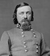
John Ferry
Overland co-designer
I understand the problem.
My initial comment was that I liked the Chancellorsville game look with respect to higher elevations.
I liked the way the hills just jumped off the map in the Chancellorsville game.
That really does not happen as much with Overland till you get to 330 feet.
The Fredericksburg area highest point is only about 180 feet and its still green pretty much everywhere.
I find it harder to discern the high ground with the Overland game.
I realize to get that look with the Overland game a new set of 2DGround50 and 2DGround100 would be required.
I appreciate you taking the time to comment.
Thanks