Established readers of the NWC Newsletter will recall the Spring 2002 Travel Supplements, "The Landscapes of Campaign Eckmuhl," Parts I & II. The publication of HPS Campaign Waterloo inspired the author to make a comparable survey of south-central Belgium. These glimpses of the 21st-Century appearance of features on the Campaign Waterloo map (and, of course, on the Talonsoft Prelude to Waterloo and Battleground Waterloo maps) are intended to enrich the gamer's appreciation of the terrain, lines-of-sight, and architecture over which our virtual campaigns are fought. As a bonus, the beauty of the region may be used to lure non-gaming spouses into vacation plans that allow the gamer to enjoy walking the hallowed ground.
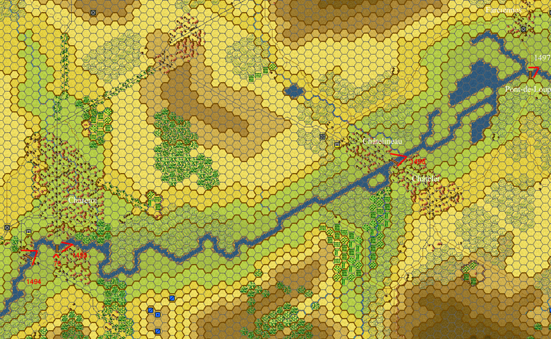
The survey is arranged by region, roughly following the chronological and geographical progression of a four-day (15-18 June 1815) campaign. On each map, a red V indicates the approximate view of each photo.
The Sambre from Merbes-le-Château to Charleroi
The south edge of the Campaign Waterloo map is cut just south of the Charleroi-Binche-Mons road (modern N 90). The section of the Sambre upstream from its appearance on the game map at (316,399) is of interest historically, because the first clash of the campaign occurred at Thuin, early on the morning of 15 June, 1815. This section of the river, free of the canalization and industrial development that has taken place around Charleroi, gives a good idea of how most of the River Sambre probably appeared in 1815.
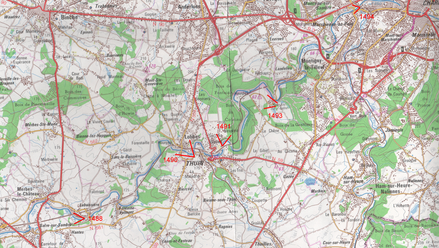
W1488. Looking upstream (west) along the Sambre from Labuissière, 10 kilometers south of Binche.
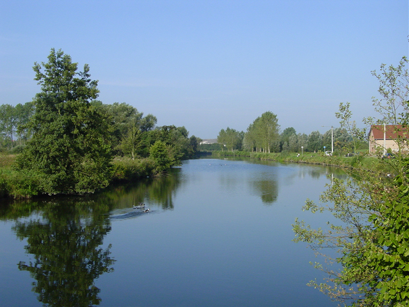
W1490. The Sambre valley at Thuin, with view of Lobbes at right.
"At 3:30 AM the large body of French that had assembled before my outposts at Lobbes the previous night,
clearly intending to attack and force us back, began firing at these outposts one by one. I was present myself, and had
already deployed my entire battalion to take account of the broken and hilly terrain. The enemy moved more and more to the
right, joining up with some others who had taken the direct way to Thuin on my left. They threw back the cavalry's
advanced observation post and, at about 4:30 AM, began bombarding the outpost at Maladrie to our east with cannon.
After a hard fight lasting 1½ hours, they forced back our troops, taking Thuin....Although I knew that Thuin had
definitely been lost, and that I myself must withdraw, I nevertheless stayed for another half hour securing the far
heights and withdrawing my various outposts which the enemy did not fire on much. I did, however, in the meantime,
hold the bridge over the Sambre with one company."
Report by Captain von Gillhausen, Prussian commander in Thuin on 15 June 1815, quoted by Peter Hofschröer
in 1815: The Waterloo Campaign, Greenhill, 1998, pp. 170-171.
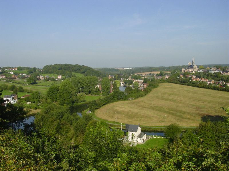
W1491. The Sambre downstream of Thuin, looking north (note high riverside bluffs).

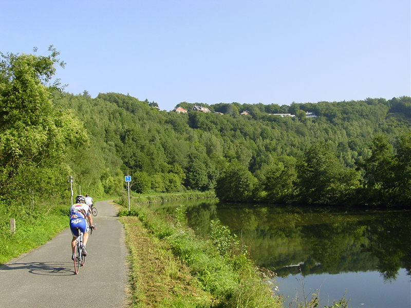
W1493. The medieval Abbey of Aulne, founded in 657 A.D., was burned by the French in 1794. It stands by a bend in the Sambre, 5 km south of Fontaine l'Evêque. The adjoining brewery and brasserie has an excellent reputation.
The banks of the Sambre from Marchienne-au-Pont east to Farciennes and beyond have suffered the ravages of 19th- and 20th-Century industrial development and urban sprawl. Charleroi boomed as a center for the coal and steel industries, but in recent decades has fallen on hard times. The entire area east to Farciennes and north to Gosselies is now built-up.
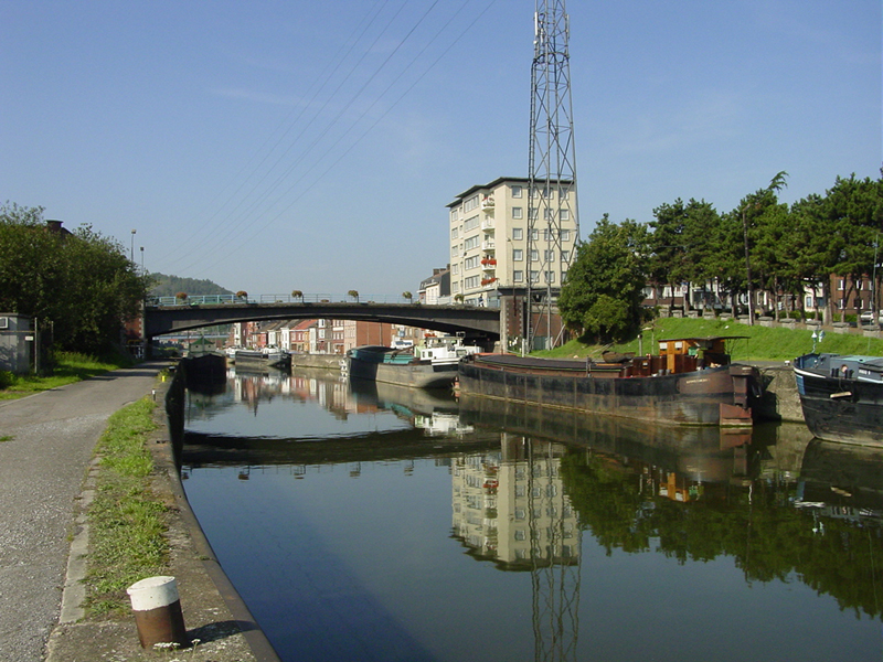
W1494. The bridge at Marchienne-au-Pont, looking upstream (southwest).
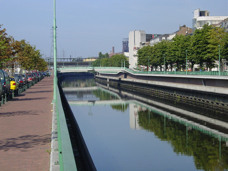
W1495. The Sambre in downtown Charleroi, looking upstream (west).

W75. Monument in the shape of a military drum, on the south bank of the Sambre in downtown Charleroi, by the central bridge, commemorating "The French armies that crossed the Sambre: Jemappes 1792, Fleurus 1794, Ligny 1815, Waterloo 1815, Louvain 1831, Antwerp 1832, Charleroi 1914, Gembloux 1940. They came to fight for liberty."

W1496. The bridge at Châtelet, looking upstream (west).

W1497. The bridge and boatyard at Pont-de-Loup, hex (419,353) on the Campaign Waterloo map, looking west.